
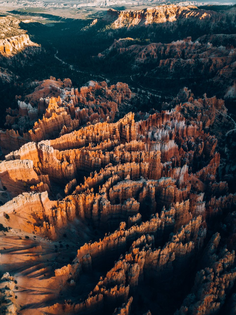
Less than two hours west of Bryce Canyon, on the far side of the Sevier valley, the same pink limestone breaks out again in a bowl that is deeper, higher and far less visited. Cedar Breaks National Monument sits on the edge of the Markagunt Plateau at 10,000 feet (3,050 m) and above, a place where spruce and bristlecone pine grow to the lip of a 2,000-foot (610 m) amphitheatre and snow lies on the road until late May. It is a half-day destination from Bryce or Panguitch, and the best answer we know to the question of where to go when the rim at Bryce is full.
Table of Contents
What it is and how it compares
Cedar Breaks is geologically a cousin of Bryce: the same Claron Formation, laid down in ancient lakes and coloured by iron, eroded into hoodoos and fins along the edge of a plateau. The differences are scale and altitude. The amphitheatre is about 3 miles (5 km) across and 2,000 feet (610 m) deep, roughly twice the depth of Bryce Amphitheater, and the rim runs between 10,000 and 10,500 feet (3,050 and 3,200 m), around 2,000 feet (600 m) higher. The colours are richer at the top, banded in orange, pink, purple and white, and the spires are broader and less orderly than the neat rows at Bryce. There is no maintained trail down into the bowl, which is one reason it is quiet: this is a place for looking from the edge and for walking along it, not through it. The monument was established in 1933 and covers a little over 6,000 acres (2,400 ha), most of it rim and meadow.
Getting there from the Bryce side
From Bryce Canyon the drive is about 65 miles (105 km) and around an hour and three quarters. We go north on Route 63 and west on Route 12 to US 89, north to Panguitch, then west on Route 143 through the forest, past Panguitch Lake at 8,200 feet (2,500 m), over a pass and down to the ski village of Brian Head at nearly 9,800 feet (2,990 m), where Route 148 turns south for the final few miles to the monument. It is a beautiful road in its own right, and in autumn the best drive for colour in this part of the state. The alternative approach from the west, up Route 14 from Cedar City, climbs more than 4,000 feet (1,200 m) in about 20 miles (32 km) and joins Route 148 from the south.
Route 148 is the catch. It is closed to vehicles from the first heavy snows, usually in November, until the road is ploughed out, typically late May, and in some years into June. The visitor centre opens with the road and closes in mid-October. Outside that window the monument is open only to skis and snowshoes, and it is spectacular that way, but it is a different sort of trip. There is a per-person entry fee for those over sixteen, and the federal annual pass covers it.
The rim and its overlooks
Route 148 runs along the rim for about 5 miles (8 km) inside the monument, and there are four main overlooks off it. Point Supreme, next to the visitor centre at about 10,350 feet (3,155 m), is the classic view straight across the bowl and the easiest to reach. Sunset View, a short walk or drive north, faces west and does what the name says in a way Sunset Point at Bryce never manages. Chessmen Ridge Overlook, further along, looks down on a row of hoodoos said to resemble chess pieces. North View, at the northern end, gives the longest perspective, down the length of the amphitheatre and out to the west. All four sit within a few minutes of each other, and a flat path called the Sunset Trail links the visitor centre to Sunset View in about a mile (1.6 km).
Two walks we always do
The monument’s two proper trails are both short and both worth the altitude. The Ramparts Trail leaves from the visitor centre and follows the rim south: 2 miles (3.2 km) round trip to Spectra Point, where a grove of bristlecone pines, some over 1,600 years old, grows on the very edge, and 4 miles (6.4 km) round trip to Ramparts Overlook beyond, with the loss and regain of about 400 feet (120 m). It is our favourite short walk in southern Utah for the combination of ancient trees, the drop below and the wind. The Alpine Pond Trail is a 2-mile (3.2 km) loop from Chessmen Ridge Overlook, through spruce and fir forest to a small spring-fed pond and back along the rim; it is gentle, shaded and full of wildflowers in July.
Both are at an elevation most visitors have never walked at before. The symptoms are real: breathlessness on the smallest rise, a headache, an odd tiredness. Walk slowly, drink more than seems reasonable, and do Bryce first so the body has a head start.
Seasons on the plateau
The season is short and each part of it has a reason to come:
- Late May to June: the road opens, snowbanks line the overlooks and the amphitheatre is at its most dramatic, with snow on the ledges of the pink rock.
- July: wildflowers peak in the meadows, with lupine, columbine, paintbrush and larkspur in fields to the rim; the monument holds a wildflower festival in the middle of the month, and afternoon thunderstorms arrive most days.
- August to mid-September: warm, clear mornings, the best time for the Ramparts Trail and for the night sky.
- Late September to early October: the aspens turn gold along Route 143 and around the rim, and the first frosts come.
Temperatures are the other surprise. It is routinely 20 to 30 degrees Fahrenheit (11 to 17 C) cooler than Cedar City at the bottom of the hill and noticeably cooler than Bryce; even in July a fleece and a windproof layer go in the bag, and in June we have been snowed on at the visitor centre. The plateau receives on average around 20 feet (6 m) of snow a year, which is why the road closes.
Night
Cedar Breaks was designated an international dark sky park in 2017, and at 10,000 feet with no town of any size within thirty miles, its sky is as dark as anything at Bryce and a fraction as busy. Summer star parties are held at Point Supreme on many weekend nights, but the simplest version needs no programme: stay for sunset at Sunset View, wait for the amphitheatre to fade to grey, and then look up. The small campground at Point Supreme, open through the summer, makes that easy, and the return drive to Bryce in the dark, over the pass and past the lake, is long enough to want to avoid. We treat Cedar Breaks as an overnight when we can, and as a long day when we cannot, and it has never disappointed either way.
Read next: Bryce Canyon Hikes: Rim Walks, Canyon Loops and How to Choose