
Ten minutes south of Cannonville the paved road ends at a basin of red cliffs studded with strange stone chimneys, and beyond it a dirt road runs on for another 40 miles (64 km) through some of the emptiest country in the Grand Staircase. Kodachrome Basin State Park and the backroad to Grosvenor Arch make a day that is the natural counterweight to Bryce: lower, warmer, quieter, and with no rim between you and the rock. We go on the second or third day of a stay, once the hoodoos have been seen, and it is usually the day people remember most.
Table of Contents
Getting there and what the park is
From Route 12 at Cannonville, a signed road runs 9 miles (14.5 km) south, paved the whole way, to the entrance of Kodachrome Basin. The park sits at about 5,800 feet (1,770 m), roughly 2,000 feet (600 m) lower than the Bryce rim, which means mornings that are warm when the rim is frosted and afternoons that are hot when the rim is pleasant. A magazine expedition in 1948 named it for the colour film it was shooting on, and the state park was created in 1962. There is a per-vehicle day fee, three small campgrounds and a visitor contact station at the entrance; it is open all year and busiest in spring and autumn.
What makes the basin unusual is the sedimentary pipes. There are 67 of them, columns of grey and white sandstone standing up to about 170 feet (52 m) tall out of the red floor and walls, and no one is entirely sure how they formed: the leading ideas involve ancient springs or geysers filling their own vents with sediment that later hardened, so the pipes survived when the softer rock around them eroded away. Whatever the mechanism, the effect is a red bowl full of pale monoliths, best in the last two hours of the day.
The walks
The park’s trails are short, well marked and easy to link. The Panorama Trail is the one to do if you do only one: a 3-mile (4.8 km) loop from the main road through the heart of the basin, with named features such as Ballerina Spire and the Hat Shop along the way, and optional spurs that stretch it to 6 miles (9.7 km) including a climb to Panorama Point for the full circle of cliffs. The Angel’s Palace Trail is a 1.5-mile (2.4 km) loop that climbs onto a mesa of red rock with sudden views down into the basin, best in early evening. The Grand Parade Trail is a flat 1.5-mile (2.4 km) walk between box canyons at the north end. And the Sentinel Trail, formerly the Shakespeare Arch Trail, still makes a pleasant short loop of under 2 miles (3 km) even though the arch it was named for collapsed in the spring of 2019, a useful reminder that this landscape is not finished.
There is little shade on any of them. In June, July and August we walk before ten and after five and sit out the middle of the day. The park is also a designated dark sky park, and a night in the campground, with the pipes as black shapes against the Milky Way, is worth planning around.
The Cottonwood Canyon Road
South of the park entrance the road continues as the Cottonwood Canyon Road, a graded dirt route that runs about 46 miles (74 km) through the national monument to the main highway near the Arizona line. The whole road follows a great tilted ridge called the Cockscomb, where the rock layers of the Grand Staircase have been folded up on edge, and the scenery is a procession of red and white cliffs, grey badlands and cottonwood-lined washes. We rarely drive it end to end. The reward for most visitors is in the first 10 miles (16 km), which end at Grosvenor Arch, comfortably done in an ordinary car when the road is dry.
The word dry is the whole matter. The surface is largely clay, and when it rains the clay turns to a grease that no tyre can grip; cars slide sideways into the ditch and stay there until the road dries, sometimes for days. A summer thunderstorm miles away is enough. The rule we follow is simple: check the road condition report at the visitor centre in Cannonville the same morning, look at the sky to the south, and turn round at the first sign of rain. High clearance helps with the washboard and the washes but is not required in dry weather.
Grosvenor Arch
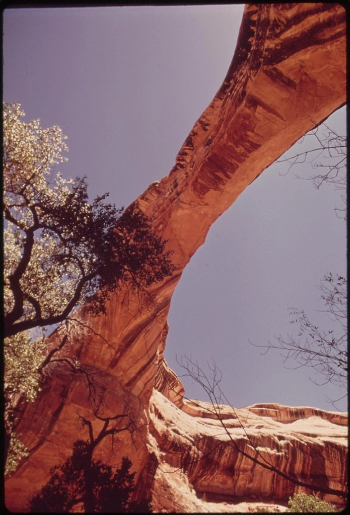
Ten miles from the park, a short spur leads to a small car park and a paved path of a few hundred yards to the foot of Grosvenor Arch. It is a double arch, two openings side by side in a buttress of cream and yellow sandstone that stands about 150 feet (46 m) high, with the larger span about 100 feet (30 m) across. Its colour is the surprise after the red of the basin: pale, almost white in the midday sun, and gold in the late afternoon when the light comes in low from the west. The arch was named after the president of the geographic society that sponsored the 1948 expedition, and it has a picnic table, a pit toilet and, most days, almost no one else. Give it half an hour; the pleasure is in sitting under it.
Further down the road, if conditions allow
Beyond the arch the road enters Cottonwood Canyon proper, and a few miles on comes to Cottonwood Narrows, a slot in the Cockscomb that can be walked as an easy 3-mile (4.8 km) out-and-back between two road pull-outs, cool and shaded in the middle of the day. Further still are the trailhead for Hackberry Canyon and the strange yellow slickrock dome called Yellow Rock, and finally the road meets the highway near the Paria River. This lower section is rougher, more remote and more exposed to flash floods, and it has no water and no phone signal; it is a serious outing rather than an extension of the arch trip.
A companion backroad also leaves Cannonville: the Skutumpah Road, heading south-west toward Kanab. Six miles (10 km) down it is Willis Creek, one of the friendliest slot canyons in southern Utah, where a small stream has cut a walkable corridor with walls that rise to 200 feet (60 m), about 5 miles (8 km) round trip with no scrambling. The same clay warning applies.
Putting the day together
Our version starts in the basin while the light is still soft, walks the Panorama Trail, drives to Grosvenor Arch for a late lunch under the stone, then returns for the Angel’s Palace loop in the last light and stays for the stars. It is a day of perhaps 40 miles (64 km) of driving from Cannonville and no more than 6 miles (10 km) on foot, and it needs only water, a hat, a full tank and a dry forecast. That last item is the one people forget.