
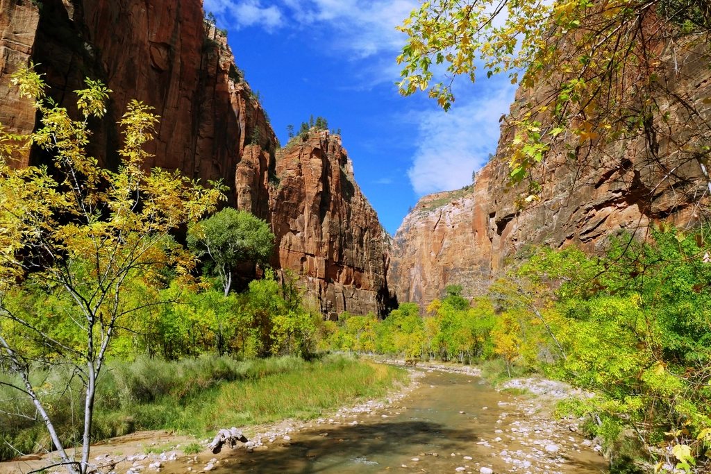
Most people arrive in Zion the same way: up from the interstate, through the gateway town at the mouth of the canyon, into a queue of cars at the south entrance. Coming from Bryce, we do it differently. We drop off the high plateau, follow US-89 south through the valley, turn west at Mount Carmel Junction and enter the park through its east gate. It is a quieter, slower and, we would argue, more beautiful approach. It also happens to put the finest short walk in the park right beside the road before you ever reach the crowds.
Table of Contents
The drive down from Bryce
From the rim of Bryce Canyon to the east entrance of Zion is roughly 70 miles (113 km), which takes about an hour and three quarters without stops. The route descends steadily: Bryce sits between 8,000 and 9,000 feet (2,440 to 2,740 m), while the floor of Zion Canyon is close to 4,000 feet (1,220 m). Expect a temperature swing of 15 to 20 degrees Fahrenheit between the two, more in summer. Keep water and a hat within reach.
The road south on US-89 passes through Long Valley, a green strip of ranch land along the East Fork of the Virgin River. From Mount Carmel Junction, where you turn onto State Route 9, it is about 12 miles (19 km) to the park boundary, climbing gently through pinyon and juniper as the cliffs begin to close in.
The Zion-Mount Carmel Highway
State Route 9 inside the park is known as the Zion-Mount Carmel Highway. It was finished in 1930 and remains an engineering landmark: a narrow ribbon of asphalt that crosses the slickrock plateau of the east side, threads a tunnel through the cliff and then drops into the main canyon on a series of switchbacks. The tunnel is 1.1 miles (1.8 km) long, cut through solid sandstone, with a handful of gallery windows that flash brief views of the canyon as you pass. It is dark and narrow, so slow down, use your headlights and do not stop.
The tunnel was built for the cars of the 1930s. Larger vehicles, including most RVs and trailers over a certain width or height, are not allowed through it without a ranger escort that stops opposing traffic, and there is a charge for that service. If you are travelling in anything bigger than a standard car or van, check the current size limits and escort hours before you leave Bryce. Escorts are not available around the clock.
The east side of the highway, before the tunnel, is the part people underrate. This is a landscape of cross-bedded Navajo sandstone shaped into domes, hoodoos and the famous Checkerboard Mesa, a rounded white cliff etched with horizontal bedding and vertical cracks that make it look like a giant piece of graph paper. There are several pull-outs, and bighorn sheep are often seen on the slickrock early in the morning.
Canyon Overlook Trail
Just east of the tunnel, a small parking area serves the Canyon Overlook Trail. This is the walk we recommend to anyone with only a few hours in Zion. It is about 1 mile (1.6 km) round trip with around 160 feet (50 m) of elevation gain, and it takes most people 45 minutes to an hour at a leisurely pace. The path climbs stone steps, passes under an overhang, crosses a short stretch of railed ledge and ends at a sandstone platform above the great bend of Pine Creek Canyon. From the edge, you look straight down the switchbacks of the highway and out across the main canyon to the towers on the far side. In the early morning the light pours in from behind you and the cliffs glow.
The parking lot is small and fills quickly, usually by mid-morning in spring and fall. There is no shuttle to this trailhead, so arriving early is the only reliable strategy. The trail has drop-offs and little shade at the top, so bring water even in cool weather.
How the shuttle works
Below the switchbacks, the highway reaches the floor of Zion Canyon and meets the Zion Canyon Scenic Drive, the dead-end road that runs up the canyon along the Virgin River. For most of the year, roughly from early spring until late in the fall, that road is closed to private vehicles. The only way up the canyon is on the free park shuttle, which departs from the visitor center near the south entrance. A second, separate shuttle loops through the gateway town outside the park so that visitors staying there can leave their cars where they sleep.
This matters when you arrive from the east, because you will drive past the shuttle stops on your way down and cannot simply turn up the scenic drive. The practical sequence is this: drive through the tunnel, descend the switchbacks, continue to the visitor center, park (or, if the lot is full, park in town and ride the town shuttle back), then board the canyon shuttle. The park shuttle makes a series of stops on the way up, including the trailheads for the popular walks, the lodge area, the Grotto and the Big Bend, ending at the Temple of Sinawava. From the last stop, the paved Riverside Walk runs another 2.2 miles (3.5 km) round trip to the point where the Narrows begin.
In winter, when shuttle service pauses, private cars are allowed up the scenic drive. This is one reason a cold-weather trip from Bryce is so appealing: you can drive to the trailheads at your own pace, and the canyon walls hold a dusting of snow.
Permits, heat and timing
Two things have changed in Zion in recent years. The first is that the famous walk to Angels Landing now requires a permit issued by lottery; you apply online, either months ahead or the day before, and only ticket holders may go past the junction below the chains. The second is that the whole park is simply busier. Parking lots at the visitor center are often full by nine in the morning during the high season, and shuttle lines can run long at midday.
Our suggestion for a day trip from Bryce is straightforward. Leave early, ideally before sunrise, so that you reach Canyon Overlook while the parking is open and the light is good. Descend into the canyon and ride the shuttle up before the midday heat, which in summer routinely passes 100 F (38 C) on the canyon floor. Walk the Riverside Walk or one of the shorter trails, then return the way you came in the late afternoon, when the east side is bathed in warm light and the pull-outs are nearly empty. Allow a full two hours for the drive back: the road north crosses open range, and deer stand on the shoulders after dusk.