
The long run south is mostly one interstate, but the final choice of entrance, and the season you travel in, decide how smooth the day feels. This guide explains why each of those choices matters before it tells you what to do about them.
- Highway 9 through the Zion – Mount Carmel Tunnel is the one stretch where vehicle size can change your plan.
- The season decides whether you ride the shuttle or drive the canyon road yourself.
Table of Contents
Why does the route south matter before you reach the park?
Zion is not a single doorway. It is a large park made up of separate sections, and the one you aim for from Salt Lake City determines which road you finish on. Understanding that layout first saves you from treating the drive as a simple dot-to-dot run.
The park lies mostly in southwestern Utah, across parts of Washington, Iron and Kane counties, at the point where the Colorado Plateau, the Great Basin and the Mojave Desert meet. That meeting of regions is why the scenery changes so quickly as you travel toward it, and it is also why the park has several quite different areas rather than one entrance gate.
The northern part of the park is the Kolob Canyons section, and it is reached from Interstate 15 at exit 40. Because that exit sits right on the interstate you will already be using, it is the easiest place to touch the park without leaving the highway for long. The main canyon and the town of Springdale lie further along, and the east side of the park is served by a different road entirely, which is covered below.
The practical reading of this is simple. Decide early whether you want a short look at the quieter northern section, the full canyon experience, or both. Each choice changes where you leave the interstate, and it is much easier to make that decision at your breakfast table than at an exit ramp.
What is the Kolob Canyons section, and is it worth a stop?
The Kolob Canyons section is the part of Zion that most travelers heading south on the interstate pass without realizing it is there. It lies in the northwest of the park, close to Cedar City, and it works best as a break in a long drive rather than as a destination in its own right.
Its features include Tucupit Point and Kolob Arch, which is described as one of the world’s longest natural arches. If your timing allows only one short detour, this is a good candidate, because you get a first impression of the park’s red rock without committing to the crowds you may meet further south.
There is also a separate area called Kolob Terrace, northwest of the main canyon. It has a slot canyon known as The Subway and a wide view over the whole region from Lava Point. These are better suited to a second visit or a longer stay, since they ask for more time than a quick stretch-your-legs stop.
A useful way to think about it is as a choice between breadth and depth. A short visit to the northern section gives you a taste and breaks up the drive. A full day in the main canyon gives you the scenery most people picture when they think of Zion. Trying to do both in a single afternoon usually means doing neither well, so it is wiser to pick the one that suits your schedule and leave the other for later.
- Choose Kolob Canyons if you want a quick, quiet look and a break from the road.
- Choose the main canyon if you have most of a day and want the best-known views.
- Save Kolob Terrace for a longer trip with more flexible hours.
How do the shuttle and the canyon road change by season?
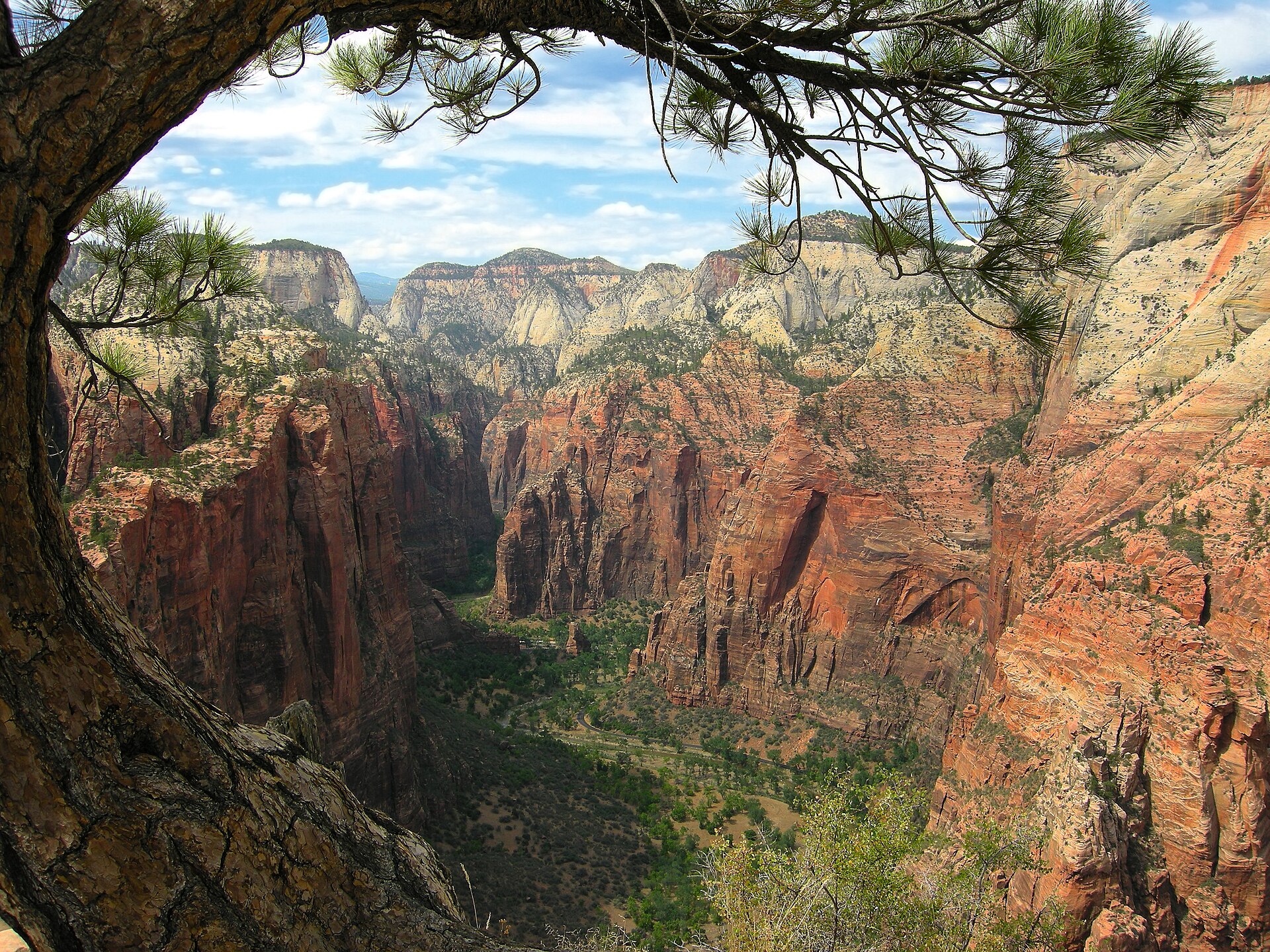
Once you reach the main canyon, the way you move around depends on the time of year, and this is where many first-time visitors are caught out. The road into Zion Canyon is about six miles long and ends at the Temple of Sinawava, where the canyon narrows and a trail continues toward The Narrows.
For much of the year that road is served by a free shuttle bus. The shuttle runs from early April to late October. In the other months, private vehicles can use the canyon road directly. Other roads in the park stay open to private vehicles all year.
The reason this matters is timing. In the shuttle season, your day is built around when you board and when you return, and a late start can mean you spend more of it waiting than walking. In the months without the shuttle, you keep control of your own schedule, but you also take on the responsibility of finding parking and of watching the weather yourself.
Weather is the other seasonal variable. Spring in this part of Utah is unpredictable, with stormy, wet days mixed with occasional warm, sunny ones. That means your packing and your plans for the day should stay flexible. Layers, extra water and a willingness to swap an exposed hike for something shorter will serve you better than a rigid itinerary.
If you can choose your dates, think about what you value. The shuttle months bring the longest days and the fullest services, while the quieter months offer a different pace and fewer people on the paths. Neither is wrong, but they ask for different preparation.
What should you know about Highway 9 and the tunnel?
The east side of Zion is served by the Zion – Mount Carmel Highway, State Route 9. It passes through the Zion – Mount Carmel Tunnel and meets US 89 at Mount Carmel Junction. Along this side of the park you will find features such as Checkerboard Mesa and The East Temple.
The tunnel is the one place on the whole journey where the size of your vehicle can change the rules. The tunnel is historic and about a mile long, and large vehicles, including RVs, typically need an escort and may face specific operating hours and fees. Because those conditions can change, the sensible habit is to check the National Park Service website for current restrictions and schedules before you set out, rather than relying on a figure you remember from another trip.
The reason for the escort system is straightforward. If you are towing, driving a camper or hiring a tall vehicle, treat the tunnel as a planning item, not a surprise.
For everyone else, the approach is a pleasure rather than a hurdle. Checkerboard Mesa stands just outside the tunnel on the east side, a sandstone formation with a cross-hatch pattern shaped by wind and water. It is an easy place to pull over, look, and let the drive slow down for a few minutes.
Winter deserves extra care here. Snow or ice can affect higher roads, so it is worth verifying road conditions, especially for the tunnel, before you travel in the colder months.
How do you make the drive part of a bigger trip?
A drive of this length rewards a little thought about what comes next. Many visitors treat Zion as one stop in a wider loop through southern Utah rather than an out-and-back trip, and the geography supports that idea well.
One common pairing is Zion with Bryce Canyon. The two parks are roughly 70 to 85 miles apart depending on the route, and the most scenic way between them takes an estimated hour and a half of driving without stops. It follows Highway 12 and US-89, then turns onto UT-9 and enters Zion by the east entrance. That is the same road through the tunnel described above, so planning for one means planning for the other.
Along that stretch, Red Canyon in the Dixie National Forest offers a small taste of hoodoos and red rock, with accessible trails and no entrance fee. It makes a fine break from the wheel.
If you are thinking of fitting both parks into a single day, be realistic. It is technically possible to see a few highlights of each, but you would only get a small taste. A minimum of one to two full days for Bryce and one to three for Zion gives you room for real walking.
Finally, book your lodging early. Rooms in and around both parks, including the base towns, tend to fill quickly in peak season. Download the official park apps and check the park websites for shuttle schedules, road conditions and trail closures. Southern Utah is a desert, so carry plenty of water, use sun protection and dress in layers.
- Decide on your entrance before you leave the interstate.
- Check tunnel rules if your vehicle is large.
- Match your dates to the shuttle season and the weather.
- Reserve lodging well ahead in summer.
Related reading
- Where to Sleep in Canyon Country: Cabins, Base Towns and the One-Hour Rule
- The Price of Remoteness: Budgeting a Canyon Country Trip
Sources
- From Bryce Canyon National Park to Zion National Park (rubysinn.com, accessed 2026-11-09)
- Zion National Park — Wikipédia (en.wikipedia.org, accessed 2026-11-09)
Photo: Angels Landing, by Tobias Alt, CC BY-SA 4.0 (Wikimedia Commons)
