
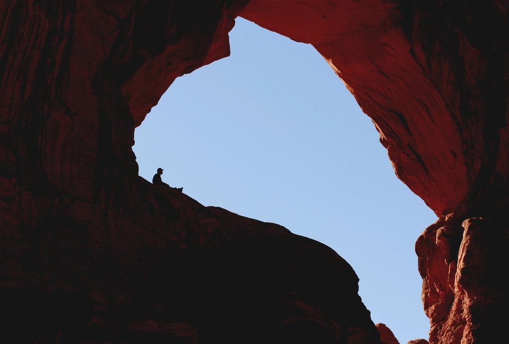
Moab is the other great red-rock base in Utah, and from Bryce it is a genuine journey: about 270 miles (435 km) and a solid five hours of driving by the shortest sensible route. That distance stops a lot of people. But two nights in Moab, bracketed by two long and spectacular drives, give you the two national parks of the east, Arches and Canyonlands, at their best, and the road there is not a chore to be endured but half the point. Here is how we shape it.
Table of Contents
The road east
There are two ways to go, and we use one out and the other back. The scenic route follows Highway 12 east from Bryce over Boulder Mountain to Torrey, then State Route 24 through Capitol Reef and the badlands beyond to Hanksville, north to Interstate 70 at Green River, and finally south on US-191 to Moab. It is about 270 miles and takes five hours without stops, which nobody manages, because Highway 12 and the Fruita section of Capitol Reef beg for pauses. Leave Bryce at dawn and you can be walking in Fruita by mid-morning and in Moab by late afternoon.
The faster alternative goes north on US-89 through Panguitch to the interstate near Salina, then east along I-70 across the San Rafael Swell, a stretch of over 100 miles (160 km) with no services and some of the finest freeway scenery in the country, and south from Green River. It is a little longer in miles and about the same in time, but it is all highway. We take it on the way home, when the legs are tired and the light is fading.
Two practical warnings. Fill the tank at Torrey or Hanksville, because the stretch to Green River is long and empty, and fuel on the interstate is scarce. And do not count on a phone signal between Torrey and the interstate; download maps before you leave Bryce.
Moab and the heat
Moab sits at about 4,000 feet (1,220 m) on the Colorado River, more than 4,000 feet lower than Bryce. That changes everything about the weather. Summer afternoons run to 100 F (38 C) and beyond, and walking at midday in July is unpleasant at best and dangerous at worst. Spring, from March to May, and fall, from mid-September to early November, are the seasons Moab is built for; the town is packed then, so book beds well ahead. Winter is quiet and cold, with occasional snow that dusts the arches and melts by noon, and it is a wonderful time to be there if you can tolerate short days.
The town is a compact strip along US-191 with everything a visitor needs, and it serves as the trailhead for both parks. Arches begins 5 miles (8 km) north of the centre; the Island in the Sky district of Canyonlands is about 32 miles (51 km) away by road. Plan on one park per day.
Day one: Arches
Arches protects more than 2,000 natural stone arches on a plateau of salmon-coloured Entrada sandstone. During the busy months of the year the park operates a timed-entry system: you reserve an arrival window online in advance, and without one you cannot drive in during the day. The rules and the dates change, so check them before you leave Bryce, and reserve early. Entry before sunrise and after the reservation hours in the evening is usually possible without a ticket, and those are the finest hours anyway.
The park road runs about 18 miles (29 km) from the entrance to its end at Devils Garden, and it can be done, with the classic short stops, in a day. Our order is dictated by heat and light. Start before sunrise on the walk to Delicate Arch, 3 miles (4.8 km) round trip with about 480 feet (150 m) of climbing over open slickrock; there is no shade, and the arch, standing alone on the edge of a natural bowl with the La Sal Mountains behind it, is best in first light. Move on to the Windows section, where three large arches and Double Arch are reached by walks of under a mile, and then to the trail at Devils Garden, where Landscape Arch, a span of about 290 feet (88 m) so thin it seems impossible, is an easy 1.9 miles (3 km) round trip. Retreat to town for the hottest hours, and return in the evening for a slow drive through the Park Avenue and Courthouse Towers section, where the fins glow at sunset.
Day two: Canyonlands, Island in the Sky
Canyonlands is enormous and divided by the rivers into districts that do not connect by road. From Moab, the practical one is Island in the Sky, a high mesa wedged between the Green and Colorado rivers with sheer cliffs on every side. The drive from town climbs a long grade to the mesa top at about 6,000 feet (1,830 m), cooler than Moab and often breezy.
The mesa is mostly driven, not walked. Grand View Point, at the southern tip, looks down more than 1,000 feet (300 m) to the White Rim, a bench of pale sandstone, and beyond it another thousand feet to the rivers, with the canyons stretching to the horizon in every direction. Green River Overlook, on the west side, shows the other river in the same way. Mesa Arch is a short loop of about half a mile (0.8 km) to a small arch on the cliff edge that frames the canyons below; it is famous at sunrise, when the underside of the arch catches the reflected light and photographers line up three deep. Go at any other hour if you want the arch to yourself.
On the way back to Moab, the state park at Dead Horse Point, on a neighbouring promontory just outside the national park boundary, gives a view of a great bend of the Colorado 2,000 feet (600 m) below. There is a separate entrance fee.
Making the two days fit
- Drive out via Highway 12 and Capitol Reef, back via I-70 and US-89; each direction is a full day with stops.
- Book two nights in Moab and reserve the Arches entry window as soon as dates are known.
- Do Arches on the first full day with a pre-dawn start, Canyonlands on the second.
- Carry at least a gallon (4 litres) of water per person per day and start every walk before nine in warm months.
- Consider a third night if you want the River Road along the Colorado or the Needles district, which is a long day on its own.
Four days from Bryce and back, two of them on the road, may sound like a lot for two parks. It is not. Between the aspens of Boulder Mountain, the orchards of Fruita, the swell along the interstate and the arches and canyons at the end, the loop touches nearly everything that makes southern Utah worth the distance, and it returns you to the plateau with a clearer sense of how the whole country fits together.