
Grand Staircase-Escalante is not a park in the way Bryce or Zion are parks. It is a national monument of nearly 1.9 million acres, larger than Delaware, with almost no paved roads inside it, a scattering of trailheads, and no entrance gate at all. That looseness is the whole appeal. From Bryce you are on its edge within an hour, and within two you can be standing beneath a waterfall in a hidden canyon or squeezing sideways through a slot barely wider than your shoulders. Here is how we introduce it to friends visiting for the first time.
Table of Contents
What the monument is
The name describes two things. The Grand Staircase is the sequence of cliffs that climb in steps from the Grand Canyon to the top of the Paunsaugunt Plateau: Chocolate, Vermilion, White, Grey and finally the Pink Cliffs, which are the hoodoos of Bryce itself. Escalante refers to the Escalante River and its vast canyon system, which drains east toward Lake Powell. Between them lies the Kaiparowits Plateau, a high, dry, empty tableland. The monument was created in 1996 and its boundaries have been adjusted more than once since; the current figure is about 1.87 million acres (757,000 hectares).
Practically, most visitors experience the Escalante side, reached by Scenic Byway 12. The small town of Escalante, about 50 miles (80 km) east of Bryce, is the base, with a visitor center at its western end where you can check road conditions and buy the maps you will genuinely need. Cell coverage disappears a few miles out of town in every direction.
Lower Calf Creek Falls
If you do only one walk, make it this one. The trailhead is at a small campground on Highway 12, about 15 miles (24 km) east of Escalante, where the road crosses Calf Creek. There is a day-use fee paid at the trailhead. The trail runs up the canyon for roughly 3 miles (4.8 km) each way, 6 miles (9.7 km) round trip, following the creek beneath walls of golden Navajo sandstone streaked with dark desert varnish. It is mostly flat, but much of it is deep sand, which makes the miles feel longer than the number suggests. Allow three to four hours.
The reward is a waterfall 126 feet (38 m) high pouring over a lip of rock into a deep, cold pool fringed with moss and maidenhair fern. On a hot day people wade in; the water is snowmelt-cold even in August. Along the way there are pictographs on the far canyon wall, visible with sharp eyes or binoculars, and beaver ponds in the creek. Start early in summer. The canyon is an oven by noon, there is little shade on the upper half, and a litre of water per person is the minimum. The trailhead parking is small and fills by mid-morning in spring and fall.
Hole-in-the-Rock Road
Five miles east of Escalante, a graded dirt road leaves Highway 12 heading southeast. This is Hole-in-the-Rock Road, roughly 57 miles (92 km) of washboard that ends at a notch in the cliffs above Lake Powell. The name comes from a Mormon expedition of 1879 and 1880 that blasted and chiselled a passage through that notch and lowered its wagons down to the Colorado River on the way to found a settlement in the southeast corner of the territory. The road was their route, and the notch, when you finally reach it, remains an astonishing piece of work.
Most people do not go all the way. The first 30 miles (48 km) are usually passable in an ordinary car when dry, though the corrugations rattle everything loose and a slow pace is essential. Beyond that, the road deteriorates and high clearance becomes necessary. After rain, the whole road can turn to impassable mud in minutes. Two rules we never break: check the forecast and road report at the visitor center the morning we go, and carry a spare tyre we have inspected, a full tank and at least a gallon of water per person. There is no fuel, no water and no signal anywhere along it.
The road passes several places worth a stop. Devils Garden, about 12 miles (19 km) in, is a compact field of hoodoos and small arches you can wander in an hour, ideal for children. Dance Hall Rock, near mile 36, is a natural amphitheatre of slickrock where the pioneers reportedly held dances during their long winter camp. And at roughly mile 26, the Dry Fork trailhead gives access to the slot canyons.
The slot canyons
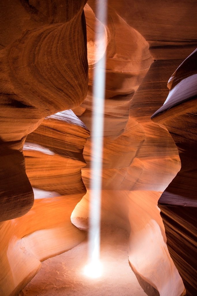
Slot canyons are narrow, deep clefts cut by water into sandstone, often only a few feet wide and a hundred feet deep. The Escalante country holds hundreds of them. Two of the most accessible open off the Dry Fork of Coyote Gulch, at the end of a rough spur road from Hole-in-the-Rock Road. Peek-a-boo is a short, playful slot that begins with a climb of about 12 feet (3.6 m) up a smooth wall and continues through a series of arches and potholes. Spooky, a little further down the wash, is longer and far narrower, in places under a foot wide, and it demands taking off your pack, turning sideways and sliding. The usual loop, up Peek-a-boo and down Spooky, is about 3.5 miles (5.6 km) and takes three hours with the scrambling. Larger people, and anyone who dislikes tight spaces, will not enjoy Spooky.
Closer to the highway, the Zebra slot, reached by a walk of about 2.5 miles (4 km) each way from a pull-out at roughly mile 8, is famous for its striped walls. It is short, often has standing water in its lower section, and is best in late spring or fall when the pools are low.
The rule that governs every slot canyon is simple: never enter one when rain is possible anywhere upstream, even if the sky above you is clear. Flash floods travel down these canyons as walls of water and debris, and there is no escape once you are inside. The visitor center posts flood potential daily. If it is anything other than low, walk somewhere else.
Putting a day together
Our standard first-day loop from Bryce is to leave early, walk Calf Creek in the cool of the morning, eat lunch at the trailhead, then drive Hole-in-the-Rock Road as far as Devils Garden for an easy afternoon among the hoodoos, returning to the plateau by dinner. The slots are better saved for a second day with an early start, a dry forecast and a night spent in Escalante or Boulder, which removes two hours of driving from the equation. Either way, wear shoes you do not mind filling with sand and carry twice the water that seems reasonable. The monument does not forgive casual planning, but it rewards a little care with some of the strangest and most beautiful ground in North America.